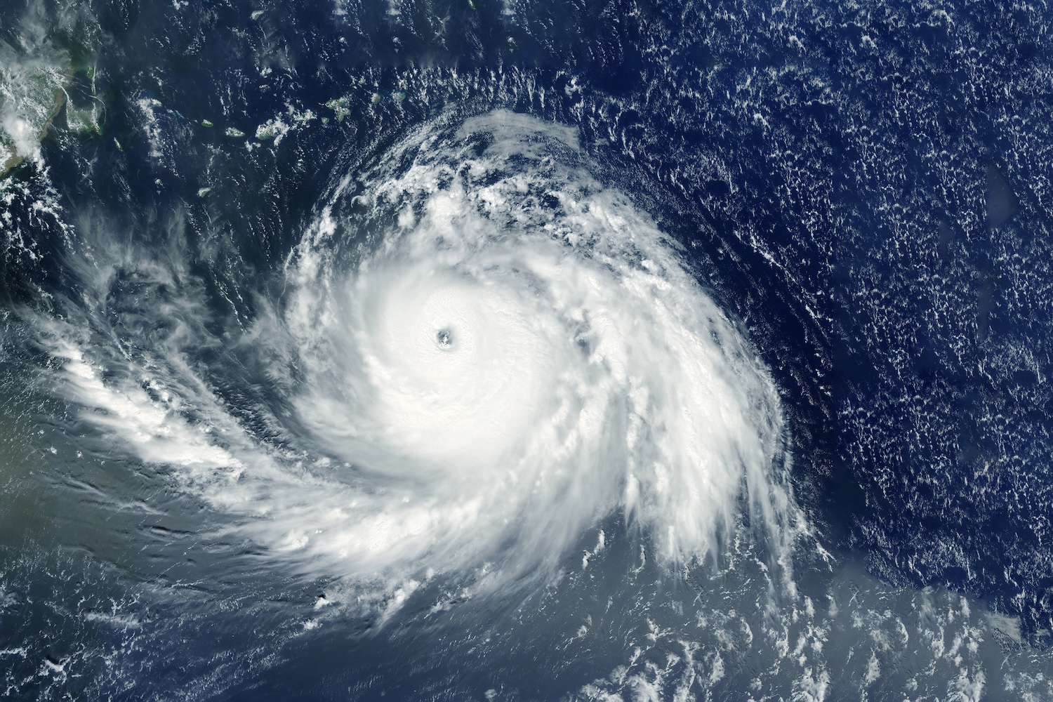
Hurricane Melissa has intensified into a catastrophic Category 5 storm, becoming the most powerful hurricane to strike the Caribbean since Hurricane Gilbert in 1988.
The U.S. National Hurricane Center (NHC) has warned of life-threatening conditions as Jamaica faces torrential rains, devastating winds, and widespread flooding through Tuesday.
At 8 a.m. ET Monday, Melissa was located about 135 miles southwest of Kingston. Officials have urged residents to seek shelter immediately, with conditions expected to worsen throughout the day and into early Tuesday.
Melissa marks the third Category 5 hurricane of the 2025 season, a rare and alarming statistic. The last time the Atlantic saw more than two storms of this magnitude in one season was in 2005, the year of Hurricanes Katrina and Wilma.
Even more striking, Melissa is the latest Category 5 hurricane in 27 years, since 1998’s Hurricane Mitch.
The slow-moving system is expected to bring 15 to 30 inches of rain across Jamaica, with some eastern regions potentially facing up to 40 inches, more than what many areas receive in an entire year.
These deluges could trigger catastrophic flash flooding, mudslides, and long-term damage to the island’s infrastructure.
The Jamaican government is scheduled to address the nation at 11:30 a.m. Monday, with emergency shelters already reaching capacity in several parishes.
Officials are urging residents to remain indoors and stay put until conditions improve.
The NHC emphasized that storm surge and wind speeds in elevated areas could reach 30% higher than the main system, meaning mountainous regions might experience gusts exceeding 200 mph. Such winds have the potential to flatten homes, uproot trees, and sever critical power and communication lines across the island.
After battering Jamaica, Melissa is projected to move across southeastern Cuba Tuesday night as a Category 3, then weaken slightly before hitting the southeastern Bahamas on Wednesday as a Category 2.
Forecasters caution that the storm’s slow pace could prolong damage and flooding across multiple countries.
Photo Credit: DepositPhotos.com